THE CLASSIC COLLECTION✦Basque Legends; With an Essay on the Basque LanguageCLASSIC FREE BOOKS
Basque Legends; With an Essay on the Basque Language
Wentworth Webster
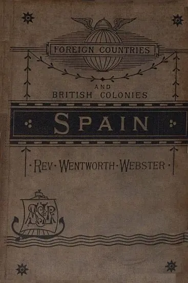
THE CLASSIC COLLECTION · 1892
"Spain" by Wentworth Webster is a geographical and cultural account written in the late 19th century. The work explores the diverse provinces of Spain, delving into its geography, climate, natural resources, and the unique attributes of its various regions. It aims to provide a comprehensive understanding of the country's physical and social landscape, highlighting the distinctions between different areas, from the northern provinces to the southern coast. At the start of the book, the author addresses the complexities involved in accurately portraying Spain due to its varied geography and the unreliable nature of official statistics. The opening portion outlines the geographical layout of Spain, discussing its boundaries, climate variations, and the significance of its mountain chains and river systems. The text emphasizes how these physical features shape not only the environment but also the cultural and political aspects of the populations living in different provinces, setting the groundwork for a thorough exploration of Spain's multifaceted identity.
Introduction adapted from the source catalogue; source summaries may be automatically generated.
Free to read · English · 54,965 words · No account needed
MAKE TIME FOR A GOOD BOOK
On by default. Untick to stop anonymous reading totals. Each page counts after 10 seconds in view. How this works.
Anonymous counting is on unless you have switched it off.
The exact source of the Guadiana has been a subject of much debate and of many fables. Its true origin seems to be in a series of lakes at the junction of the provinces of Ciudad Real and Albacete, near Montiel, in La Mancha. A picturesque stream, the Ruidosa, with many cascades and broken water, connects these lakes; but after running a few miles in a north-westerly direction, it disappears underground near Tomesillo, and is believed to rise to the surface after about twenty miles, in the Ojos (eyes) of the Guadiana, near Damiel. Very soon it receives from the right the united waters of the Zancara and the Giguela, streams whose contributions are much more scanty, especially in summer, than the length of their course on the map would lead one to suppose; thence the river flows in a westerly direction, passing near Ciudad Real, below which the Javalon enters from the left, coming from the Campo de Montiel; near Don Benito the Zuja, from the Sierra Morena, joins it, and some miles lower down the Matachet. Flowing past Medellin, five miles below Badajoz the river crosses the frontier of Portugal, changes its course from westerly to south-west, and afterwards south and south-east, till it again joins the frontier near San Lucar, and dividing the two countries till its mouth, falls into the Gulf of Cadiz at Ayamonte. In the lower part of its course the river, which before has been wide and shallow, and often almost dry in summer, narrows its course, and rushes with impetuosity through the rapids called the Salto del Lobo (the wolf's leap), near Serpa, in Portugal. The whole length of the Guadiana is estimated at 550 miles, and the area of its bed at 24,000 square miles. The rainfall is about fourteen inches.
To the south of the rivers of the plateau the only considerable stream is the Guadalquiver, with its tributaries. The character of this river is entirely different to that of the former streams. Like the Ebro, it forms a true valley, instead of merely cutting its way through rocks, canons, and defiles. Its bed is on an average about 1200 feet below that of the Guadiana in the greater part of its course. It is also the only river in Spain of any utility for navigation; the tide is felt beyond Seville, and vessels of 200 to 300 tons ascend to that city. There are also several lines of steamboats trading thence directly with London, Marseilles, Bilbao, Cadiz, and Gibraltar. The Guadalquiver takes its rise from two sources--one, in the streams Guadalimar and Guadarmeno, rises in the Sierra Alcaraz, and not very far from the sources of the Guadiana; the other, which bears the name of the Guadalquiver, in the south-west of the Sierra Sagra; this latter branch is soon joined by the Guadiana Menor, coming down from the Sierra Nevada. The basin of the Guadalquiver presents this peculiarity, that its boundary is not formed by the line of the highest summits; on the contrary, many of its tributaries take their rise on the farther side of the Sierra Morena on the north, and of the Sierras de Granada and Nevada on the south, and have cut their way through these higher grounds to join the Guadalquiver in the plains of Andalusia. The upper part of its course is very rapid, and the junction of the two rivers Guadalimar and Guadalquiver, in the plains of Baeza, is about 5000 feet below the Punta de Almenara; but from thence to the sea the fall is very slight. After the junction the river passes by Andujar, Montoro, and Cordova, receiving on both banks the waters of many streams of but little importance; but between Cordova and Seville it is joined by its largest tributary, the Xenil, which rises in the Sierra Nevada, and flowing through the celebrated Vega of Granada, bursts through the Antequera mountains to enter the great plain of Andalusia, and loses itself in the Guadalquiver. From Seville downward the character of the stream is greatly changed; it wanders in large meanderings through low and marshy grounds for two or three leagues on each bank, mostly uninhabited, and used only for pasturing cattle. These low lands, which are called Marismas, in dry weather are covered with clouds of black dust, and in wet are an almost impassable slough of mud; mid these the river divides, and its winding beds form two islands--Isle Mayor and Menor, the former of which is wholly given to cattle, while the latter is inhabited and well cultivated; The river finally enters the Gulf of Cadiz, at San Lucar de Barameda, forcing its way with difficulty through low hills of sand, like those of the Landes in France. The marshes near the mouth are utilized as Salinas, for making excellent salt; and on the hills which overlook the Marismas some of the most renowned wines and fruits of Spain are produced. The whole course of the Guadalquiver is about 340 miles and the area of its basin 21,000: the rainfall is estimated at nineteen inches.
Your reading position is saved on this browser. Take it to another device with a library code. Reading pages adapt to text, rather than matching a printed edition.
BEHIND THE BOOK
This eBook is for the use of anyone anywhere in the United States and most other parts of the world at no cost and with almost no restrictions whatsoever. You may copy it, give it away or re-use it under the terms of the Project Gutenberg License included with this eBook or online at www.gutenberg.org. If you are not located in the United States, you will have to check the laws of the country where you are located before using this eBook. Read the source licence.
The original source file, including credits and licence, is retained by this library. Request an original-format copy at no charge. Please include the book title and Project Gutenberg identifier #34875.
KEEP YOUR CURIOSITY GOING
Wilfrid Scawen Blunt
Wilfrid Scawen Blunt
E. W. (Edgar Watson) Howe
Cécile Tormay
Moritz Busch
John L. Ransom