THE CLASSIC COLLECTION✦Basque Legends; With an Essay on the Basque LanguageCLASSIC FREE BOOKS
Basque Legends; With an Essay on the Basque Language
Wentworth Webster
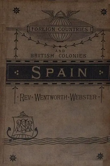
THE CLASSIC COLLECTION · 1892
"Spain" by Wentworth Webster is a geographical and cultural account written in the late 19th century. The work explores the diverse provinces of Spain, delving into its geography, climate, natural resources, and the unique attributes of its various regions. It aims to provide a comprehensive understanding of the country's physical and social landscape, highlighting the distinctions between different areas, from the northern provinces to the southern coast. At the start of the book, the author addresses the complexities involved in accurately portraying Spain due to its varied geography and the unreliable nature of official statistics. The opening portion outlines the geographical layout of Spain, discussing its boundaries, climate variations, and the significance of its mountain chains and river systems. The text emphasizes how these physical features shape not only the environment but also the cultural and political aspects of the populations living in different provinces, setting the groundwork for a thorough exploration of Spain's multifaceted identity.
Introduction adapted from the source catalogue; source summaries may be automatically generated.
Free to read · English · 54,965 words · No account needed
MAKE TIME FOR A GOOD BOOK
On by default. Untick to stop anonymous reading totals. Each page counts after 10 seconds in view. How this works.
Anonymous counting is on unless you have switched it off.
For while it is distinctly separated from the rest of Europe by the line of the Pyrenees, Spain is no less distinctly divided into different districts in the interior--districts which differ most widely in climate and elevation and products. Six of these are usually named: (1) The N.W. Atlantic coast, comprising Galicia, the coast of which presents a continuation of the Fiord system of Norway, and of the Firths of Scotland and Ireland; (2), the northern slope of the Cantabrian Mountains, and the narrow slip of land contained between them and the Bay of Biscay, comprising the Asturias, Santander, and the Basque Provinces; (3) the Valley of the Ebro, with Navarre, Aragon, and Catalonia; (4) the great Central Plateau--Leon, Old and New Castile, Estremadura, and La Mancha; (5) the Mediterranean Provinces, including Valencia, Murcia, and the parts of Andalusia between the Sierra Nevada and the Mediterranean; (6) the rest of Andalusia sloping towards the Atlantic.
We will treat of these in order.
Mountain Chains.
But first we must speak of the various mountain systems and river basins of Spain, without which it is impossible to understand either the physical conditions of the country, or the social and political state of the various populations which has resulted from them.
First, on the north is the chain of the Pyrenees, a continuation of the great Alpine system of Central Europe, stretching from Cape Creuz, 3 deg. 19' E., to the Bay of Biscay, 2 deg. 12' W., a distance of 320 miles, and prolonging itself westward in lower chains of different denominations until it finally sinks into the Atlantic at Cape Finisterre. The culminating points of the Pyrenees are towards the centre of the chain, in Mounts Maladetta, 11,150 feet, and the Pic de Posets and the Mount Perdu, each about 11,000 feet, whence the heights gradually descend, on the east to the Mediterranean and on the west to the Bay of Biscay. With the exception of the little Bidassoa, which in the lower part of its course forms the boundary between France and Spain, at the bottom of the Bay of Biscay, all the other waters of the Spanish side of the Pyrenees belong to the Ebro and to the Mediterranean. Parallel to the coast of the Bay of Biscay the Pyrenees are prolonged, first, by the Cantabrian Mountains, which run through the Basque Provinces, and the Province of Santandar; thence by the Picos de Europa, 8300 feet--from the south-eastern spurs of which the Ebro and Pisuerga take their rise--and the Asturian Mountains, to the Sierra de Penamarella, at the junction of the three Provinces of Leon, Asturias, and Galicia. The chain here attains its greatest elevation, 9450 (?) feet, then descends to a plateau of about 4000 feet, whence it sinks rapidly to the Atlantic, forming the headlands of Ortegal, the extreme north-western, and of Finisterre, the extreme western, point of Northern Spain. The mountains of Leon form the western watershed, between the waters of the Ebro and those which fall into the Atlantic. The line is continued eastward by the Oca Mountains, the Sierra de Moncayo, and the Idubeda Mountains. These mountain chains divide the basin of the Ebro from that of the Douro. They also form the northern buttress of the great plateau of Central Spain, which attains an elevation of from 2000 to 4000 feet. The rise to the plateau from the Bay of Biscay is very abrupt. Within fifty miles of leaving the coast the railways from the north attain a height of 2000 feet, and reach the Central Plateau, at Quintanapalla, at an elevation of 3000 feet; while La Canada, the highest point on the line to Madrid, is nearly 4460 feet, or about sixty feet higher than the tunnel of the Mount Cenis. From the eastern side the rise is less abrupt, and the plateau is entered at the lower elevation of 2330 feet, on the line from Alicante to Madrid. The famous Pass of Somosierra, on the old northern coach-road from Madrid, is about 4700 feet above the level of the sea. From these figures it is easy to perceive how very different is the aspect of these buttress chains when seen from the plateau, and when looked at from the plain from which they rise. Thus the Sierra de Moncayo, 7700 feet, stands out with boldness from the Valley of the Ebro, but viewed from the plateau of Castile it is scarcely noticeable. From its summit, however, the finest view of the whole range of the Pyrenees to be found anywhere on the Spanish side of the chain, is to be obtained.
Your reading position is saved on this browser. Take it to another device with a library code. Reading pages adapt to text, rather than matching a printed edition.
BEHIND THE BOOK
This eBook is for the use of anyone anywhere in the United States and most other parts of the world at no cost and with almost no restrictions whatsoever. You may copy it, give it away or re-use it under the terms of the Project Gutenberg License included with this eBook or online at www.gutenberg.org. If you are not located in the United States, you will have to check the laws of the country where you are located before using this eBook. Read the source licence.
The original source file, including credits and licence, is retained by this library. Request an original-format copy at no charge. Please include the book title and Project Gutenberg identifier #34875.
KEEP YOUR CURIOSITY GOING
Wilfrid Scawen Blunt
Wilfrid Scawen Blunt
E. W. (Edgar Watson) Howe
Cécile Tormay
Moritz Busch
John L. Ransom